With the Marine's break between summer and fall classes approaching, the Biologist saw an opportunity to get away on a waymarking adventure. After a little bit of thought, she chose Nebraska, Kansas, and Colorado as the destination locations. Kansas and Colorado were the only two States in the continental United States where we hadn't yet found caches. Also there were a few waymark categories the Biologist needed icons for. So we made our reservations and off we went.
Day 1: We flew out of Jacksonville, Florida, bright and early and made our way to Omaha, Nebraska, with one stop in Memphis. As we were approaching Omaha, we spotted massive flooding along the Missouri River. I-29 and many homes, farms, and businesses were under water. Wow, we didn't realize the flooding was still a problem in this area or that the flooding was so extensive.
 |
| Sokol Omaha |
After picking up our rental car, we took off to our first goal, Sokol Omaha, an historic
Sokol Center in town. According to the
Dated Cornerstone, it was constructed in 1926. Next we headed to BrewBurgers, a restaurant featured on
Diners, Drive-ins and Dives, for a bite of lunch. The Marine ordered the Cheesy Sacramento Burger and the Las Vegas Fries, and the Biologist ordered the Vegetarian Burger and Homemade Cole Slaw. We also order the Spanish Onion Rings as an appetizer. We've been to numerous restaurants featured on DDD, and this was by far our least favorite. The food was either flavorless or had an odd flavor to it. Although the woman who served us was very friendly and attentive, we definitely won't be going back. Oh well, you can't win 'em all.
 |
| Forest Lawn Memorial Park Marker |
After lunch, we headed to the Forest Lawn Memorial Park, a
Worldwide Cemetery. No, no, the food wasn't quite THAT bad; we just wanted to read the
Nebraska Historical Marker about the cemetery and see if there were any interesting headstones. The cemetery is believed to be Nebraska's Most Beautiful Cemetery, and it was
Superlative for certain. In the cemetery we found a
Headstone for a Centenarian, a
Civil War Monument within a
Veterans Cemetery section, four pieces of
Static Artillery, a
Sundial, four
Woodmen of the World Graves Markers (including one belonging to Joseph Cullen Root, the founder and first president of
the Modern Woodmen of America organization), and a couple of lovely
Mausoleums. After leaving the cemetery, we decided to check into our hotel for night.
 |
| St. Cecelia's Cathedral |
Day 2: Before leaving Omaha, we decided to spend half a day wandering around town. We found a few more
Nebraska Historical Markers, including one for Malcolm X at the site of his birth home. Adjacent to this
Civil Rights Memorial is the Malcolm X Foundation headquarters. We also stopped by the Historic Prospect Hill Cemetery to read the
Nebraska Historical Marker located in this
Worldwide Cemetery and came across several
Zinc Headstones, a
Broken Column Headstone, and four
Woodmen of the World Grave Markers. We next spotted St. Cecelia's
Cathedral and stopped to take some photos of this beautiful
Catholic Church and its
Dated Cornerstone.
This Old Church is also listed on the
U.S. National Register of Historic Places! On the way back to the car, we spotted a
Cycling Route sign! All in all, a really good stop. We also stopped at the Kountze Memorial
Lutheran Church, which was located right next door to the Super 7 Doppler
Weather Radar. We stopped at several other locations before heading out of Omaha.
 |
| The Marine & the B-52 |
Our first stop outside Omaha was at Offutt Air Force Base to find a virtual cache. As we approached the entrance to the base, the Marine was very annoyed to see a group of protesters who were protesting the bombing of Japan. Maybe they would have felt differently if their grandfathers had died during the Japanese bombing of Pearl Harbor or while attacking the Japan mainland. Then again, if their grandfathers had died, they probably wouldn't be here. Anyway, the virtual was at a B-52, a
Static Aircraft Display.
Our goal for today was to reach Topeka, Kansas, by dinner, but we took a little side trip to Gretna, Nebraska, to visit the gorgeous and peaceful Holy Family Shrine. It's a lovely location and well worth a stop if you're in the vicinity, and there's even a virtual cache here!
 |
| Holy Family Shrine |
 |
| The Marine at the Holy Family Shrine |
 |
| Bobo's Drive In Neon Sign |
From the shrine, we backtracked a little to get back on our way to Topeka. We passed through the Potawatomi
Indian Reservation along the way. Upon arriving in Topeka, we first stopped by the former Patty's Place restaurant, now Bill's
Diner, which was featured in a 2006
Zippy the Pinhead comic strip. It was a little early for dinner, so we kept on going and checked into our hotel. After relaxing for a short time, we made our way to Bobo's Drive In, a restaurant featured on
Diner's, Drive-ins and Dives in 2008. The Marine had the Cheeseburger, Chili, and Homemade Apple Pie with vanilla ice cream, while the Biologist had their signature onion rings and a chocolate malt. It was delicious! Guy Fieri has redeemed himself after the BrewBurgers fiasco in Omaha yesterday! After dinner, we drove around downtown Topeka and waymarked a few gorgeous churches and found several cool
Neon Signs after dark on our way back to the hotel.
 |
| Old Dutch Mill in Wamego, Kansas |
Day 3: Today we headed west through the heartland of Kansas. Our first stop was a
Kansas Historical Marker about the town of St. Mary's, a nice small town with an
Artistic Welcome Sign and an Oregon Trail Marker denoting the location of this famous
Wagon Road and Trail. As we passed through Belvue, Kansas, we spotted a little shrine along the side of Highway 24 and thought it might qualify as a
Wayside Shrine, but alas it didn't. We'll have to wait until we travel to Europe to find one of those. We can't wait! We also stopped for a virtual cache in Wamego, Kansas, at the Old Dutch
Mill, which has a wonderful
Windmill, as well as a
Kansas Historical Marker about it.
 |
| Marine and Johnny Kaw |
We meandered along the backroads of Kansas until we came to Manhattan where we spotted a fun
Googie sign at Vista Hamburgers. Then we went to the Manhattan City Park to visit Johnny Kaw, a 30-foot tall
Statue of a Fictional Figure that was the subject of a
Zippy the Pinhead comic strip in 2005. That Pinhead sure does get around. Anyway, in 1955 in an effort to get the public and the media interested in Kansas history for its centennial. George Filinger, a Kansas State University professor, came up with the tall tale character of Johnny Kaw who used his cradle scythe to create the Kansas landscape, geography, and pioneer trails.
 |
| BOD Marker |
Next we made our way to Ellis County to find some
Butterfield Overland Dispatch Markers, one of our key goals for this trip. We drove up and down the dirt roads that passed over the old trail and found several of the markers. You had to pay close attention to spot them because they were designed to look like the historic stone fence posts in Kansas. Next we made our way to the city of Hays to bed down for the night. As we drove into town, we spotted a
Neon Googie sign for Al's Chickenette, which was featured in a
Zippy the Pinhead comic strip in 2005. Sweet!
 |
| Dodge City Silhouette Sculpture |
Day 4: Today we thought it might be fun to head to Dodge City, the old Wild West town where Wyatt Earp once served as an assistant marshal and which also served as the setting for the Gunsmoke television series. However, upon arriving in Dodge City we were overwhelmed by the cattle stench from the stockyards. OMG, it was really bad! Soooo, needless to say, we got the hell out of Dodge as quickly as possible, but not until we'd taken a photo of a cool
Silhouette Sculpture. After leaving Dodge City, we spotted some interesting
Kansas Historical Markers along the way though, including one that was the subject of a virtual cache. It pointed out some old ruts along the historic Santa Fe Trail, yet another famous
Wagon Road and Trail, still visible from the pioneer days. How cool is that?
 |
| Hand-operated Sluice Gate |
It wasn't long after we passed over the state line into Colorado that the Marine exclaimed, "Hey, I think that's an old
Hand-operated Sluice Gate." The Biologist, who had been looking down at the map on the laptop, jerked her head up and saw that he was right, so we pulled over. Isn't the Marine amazing?!!! A new waymarking icon! Woo hoo!
Soon after we stopped for our first cache in Colorado, which was a virtual cache about Camp Amache, a World War II Japanese-American Relocation Camp. We took a drive through the old Camp. About all that remains are the foundations of all the buildings that were used to house the Japanese-Americans. Next we passed through the town of Lamar where the Biologist found her first
Colorado Historical Marker about the city of Lamar at the city's Colorado
Tourist Information Center located in the historical Lamar
Train Depot. Outside the depot was a small
Equestrian Statue, a
Figurative Public Sculpture of a Pioneer Woman, a steam
Locomotive, and a
Windmill. Cha-ching! This place is a waymarking hot spot! It was getting late by this time so we made a beeline for Colorado Springs and called it a day.
 |
| Pike's Peak Cog Railway Train |
Day 5: Today we had reservations to take the Cog Railway to Pike's Peak. After checking out the
Penny Smashers at the depot for this
Engineering Landmark, we hopped on the train and enjoyed the ride to the
Mountain Summit. A couple from Key West, Florida, was sitting across from us and we had a nice time learning about their retirement adventures during the trip. By the time we got off the train at the 14,100-foot high peak, we were quite lightheaded and had a difficult time walking around. Lack of oxygen will do that to you! The Biologist convinced the Marine he should pose in the
Photo Cutout of Pike's Peak bears at the summit. We really enjoyed the beautiful, clear views in all directions and took a photo of the
Elevation Sign before we had to board the train to head back down the mountain to Manitou Springs.
 |
| Neon Sign in Manitou Springs |
In Manitou Springs, we spotted a few old neon signs that we couldn't resist stopping to photograph then we drove over to the Garden of the Gods, which our new Key West friends told us was a must-see while in the area. They were absolutely right! This place was absolutely gorgeous and reminded us quite a bit of our honeymoon in Nevada where we visited Red Rock Canyon and the Valley of Fire. It even had a huge Balanced Rock!
 |
| Garden of the Gods |
 |
| Marine and the Balanced Rock |
 |
| Overland Park Marker |
By the time we finished wandering around the Garden of the Gods, it was mid-afternoon and time to start making tracks to Denver. After checking into our Denver hotel, we grabbed a bite to eat then went and did a little exploring. We found another
Colorado Historical Marker and another virtual cache at the most unusual
Sundial we had ever seen before. It was located in the War Memorial
Rose Garden, which had a lovely
Fountain, a
Gazebo, and a couple of
Citizen Memorials. After finding a
Dairy Queen and getting a couple of Blizzards (yum), we decided to call it a night and headed back to our hotel.
 |
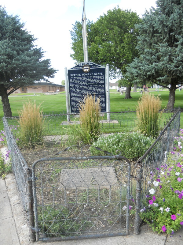
| Pawnee Woman's Grave |
Day 6: Today we needed to start making our way back to Omaha for our flight home on Friday. We decided to spend a little time looking for a couple of virtual caches in the Denver area before heading out of town. We decided to take some back roads through Kansas and were bored out of our skulls, so we decided to re-route and head north to Nebraska a little sooner than we had planned, because we just couldn't look at another corn field. Yea, we crossed the border into Nebraska! Toto, we're not in Kansas any more! Thank goodness!
Unfortunately, there a lot of corn fields in Nebraska too, but at least there were some rolling hills and several
Nebraska Historical Markers along the way. Woo hoo! Our favorite was the marker about a Pawnee Woman's
Out of Place Grave. After a long day of some of the most boring travel we've ever experienced, we decided to stop in Kearney for the night.
Day 7: This morning we decided to wander around Kearney a bit before heading northeast to Omaha. We stopped by the Kearney Cemetery, an historic
Worldwide Cemetery, and spotted a
Woodman of the World Grave Marker, two
Broken Column Headstones, an
Occupational Gravestone, a
Firefighter Memorial, a
Citizen Memorial, two
Static Artillery Displays, and a
Military Ground Equipment Display. Wow! Who would have thought there would be so much to see here?
 |
| Googie Sign |
After leaving the cemetery, we started making our way to Omaha. It wasn't long before we spotted a sign that said we were on the Lincoln Highway! We didn't even realize it went through this part of Nebraska. What a nice surprise. Along this stretch of road, we spotted several
Nebraska Historical Markers, some interesting
Lincoln Highway sites, an old
Neon Sign, a couple of cool
Googie Signs, and a beautiful
Roman Catholic Church and
Cathedral.
With all our stops, it took a lot longer to get to Omaha than we had anticipated, but we still beat the rush hour traffic. We checked into our downtown hotel and then went out and wandered along the riverfront for a little while, but part of the area was underwater due to all the recent flooding. We even found a virtual cache while we were down there. Then we made our way to a large downtown park where we walked around and looked at a few
Fountains that would have been really interesting to see if they were running, an
Architectural Remnant of the historic U.S. National Bank Building Arches, which are now
Freestanding Arches, and a really fun piece of
Artistic Seating in the shape of a frog with its tongue extended as though to catch a fly. By this time it was getting late and time to head back to our hotel.
Day 8: Today our vacation came to an end. We made our way to the airport, turned in our rental car, and boarded our flight for home. There's no place like home, there's no place like home, there's no place like home...